Electronic System of Position Fixing
Satellite Navigation Systems
The
Global Positioning System (GPS)
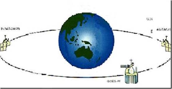 The
Global Positioning System (GPS) is a worldwide radio-navigation system formed
from a constellation of 24 satellites and their ground stations. The satellites
are all in polar orbits unlike the geo-stationary INMARSAT satellites.
The
Global Positioning System (GPS) is a worldwide radio-navigation system formed
from a constellation of 24 satellites and their ground stations. The satellites
are all in polar orbits unlike the geo-stationary INMARSAT satellites.

Thus the GPS satellites do not
have a fixed position with reference to a position on earth. They are all
moving in their orbits.
The altitude is generally about
11000 km above the earth. GPS uses these “man-made stars” as reference points
to calculate positions accurate to a matter of meters.
The NAVigation
Satellite Timing and Ranging (NAVSTAR) GPS is an all weather, radio based,
satellite navigation system that enables users to accurately determine
3-dimensional position, velocity, and time worldwide.
The overall system consists of
three major segments: the space segment, the ground control segment, and the
user segment.
The space segment is a
constellation of satellites operating in 12-hour orbits at an altitude of
20,183 km (10,898 NM).
The constellation is composed of 24 satellites in six
orbital planes, each plane equally spaced about the
equator and inclined at 55 degrees.
The ground control segment
consists of a master control centre and a number of widely separated monitoring
stations.
The ground control network
tracks the satellites, precisely determines their orbits, and periodically
uploads almanac ephemeris, and other system data to all satellites for retransmission
to the user segment.
The user segment is the
collection of all GPS user receivers and their support equipment.
More simply, the GPS Receiver’s position is
determined by the geometric intersection of several simultaneously observed
ranges (satellite to receiver distances) from satellites with known
co-ordinates in space.
The receiver measures the
transmission time required for a satellite signal to reach the receiver.
Transit time is determined using
code correlation techniques
The actual measurement is a
unique time shift for which the code sequence transmitted by the satellite
correlates with an identical code generated in the tracking receiver.
The receiver code is shifted
until maximum correlation between the two codes is achieved.
This time shift multiplied by
the speed of light is the receiver’s measure of the range to the satellite.
This measurement includes
various propagation delays, as well as satellite and receiver clock errors.
Since the measurement is not a
true geometric range, it is known as a pseudo-range.
The receiver processes these
pseudo-range measurements along with the received ephemeris data (satellite
orbit data) to determine the user’s three-dimensional position.
A minimum of four pseudo-range
observations is required to mathematically solve for four unknown receiver
parameters (i.e., latitude, longitude, altitude, and clock offset).
If one of these parameters is
known (for example, altitude fixed) then only three satellite pseudo-range
observations are required and thus only three satellites need to be tracked.
The level of accuracy is upto
100 metres. However it depends whether the chatty being used to plot the
position is using WG84 datum or not. If not then there may be corrections to be
applied prior such GPS derived positions are plotted on the charts.
Since the datum used is of so
great a factor, it always prudent ot
check on the chart whether the chart is to WGS84 datum or other. The correction
is usually printed on the chart, but if it is not then due caution is to be
used since the GPS position in extreme cases can be found to be on land.